Welcome to the Marine Exchange of Southern California
-
Reports and Target Mapping
-
Inbound Mariner Resources
-
Harbor Safety Committee Agenda
-
Harbor Safety Committee

-
Our Local Weather


Your One Stop for Maritime Information & Guidance
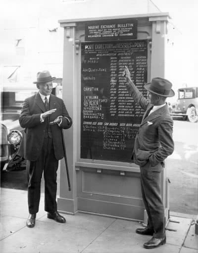
The Marine Exchange of Southern California is an over one-hundred-year-old, non-profit organization dedicated to the development and efficient flow of maritime commerce throughout the region. Our records of ship arrivals and departures go back to 1923 in a string broken only by WW II. Since then, we have evolved into the Maritime Information Center for the Los Angeles - Long Beach Port Complex.
The Marine Exchange maintains a continuous 24-hour service, and utilizes a state-of-the-art, comprehensive, computerized database system to provide vital statistics and information on ships calling at the four major ports in Southern California: Port Hueneme, Los Angeles, Long Beach, and San Diego; and the marine oil terminal at El Segundo.